Will's excellent superimposition of the Croydon Canal route on Google Maps...


Junction of Grand Surrey Canal and Croydon Canal


Five Bell Lane, New Cross


"'View from the Locks above Deptford' engraved in 1851. The fence by the head of the lock was the boundary fence between the two counties, and therefore the modern view is almost at the head of Lock No.9. Modern scenes like the one above do little justice trying to envisage how the canal looked."
Deptford/New Cross/Telegrath Hill? More info needed...


Lock House near Brockley Station area.

Apparently, one of the original lockkeeper's cottages at Brockley Way Bridge, photographed after the canal closed and was drained, probably in the 1960s.
Now thought to be of railway origin

Brockley Way Bridge

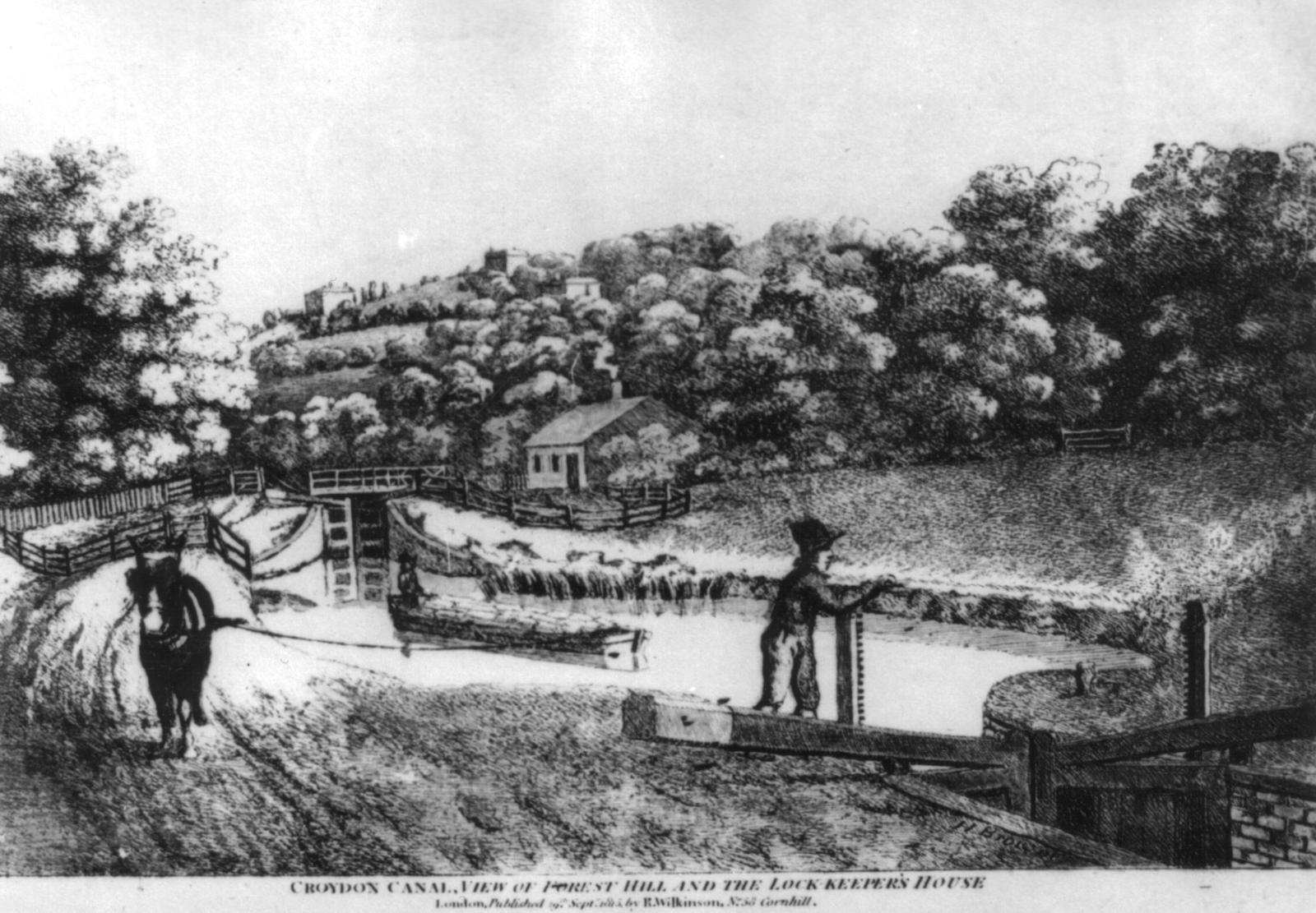
Looking southwest from Brockley towards Forest Hill with One Tree Hill in the background. More info here...

Looking northeast, "the picture shows the bottom of the staircase lock at Honor Oak, identifable because it has a swing bridge across the chamber. The small lane crossing the lock chamber, is Honor Oak Park's precessdor. Despite being a 'pair' of locks, it was numbered as one lock - 26 contrary to canal practice - the Croydon canal had a total of 29 locks when these and the two Norbury locks are included." (*UPGRADE COMING SOON)

The view is taken from Honor Oak Park in the southwest direction, showing some of the Honor Oak Road houses in the background. In the foreground is the last 2 locks of the 29 that started at New Cross to help the bargees ascend the terrain; most locks--#11 to #29--were between Brockley Station and Honor Oak Park (the predecessor to this road can be seen in the engraving crossing horizontally over the swing bridge coupled with the top of the staircase lock). It was a simple, but slow, journey from here to Croydon. Straight ahead was one of the most attractive parts of the canal set inside Honor Oak Wood. The canal emerged out of the woods when winding eastwards across the line of the future Devonshire road, before winding back round to the south towards Davids Road with woodland still on the eastern bank as far as Woodcombe Crescent.

Top of the staircase lock at Honor Oak Park, looking southwest, with the lockkeeper's cottage in the background. (*IMAGE IN NEED OF UPGRADE)

Somewhere in Sydenham (could be from the pool at the north end of Davids Road. (*IMAGE IN NEED OF UPGRADE)
Remains of the canal? Photo taken from the pathway at the side of the railway line--said to be a descendant of the canal towpath.

Sydenham Common, including the reservoir. (*IMAGE IN NEED OF UPGRADE)


Surviving stretch of the canal seen in Dacres Wood Nature Reserve.
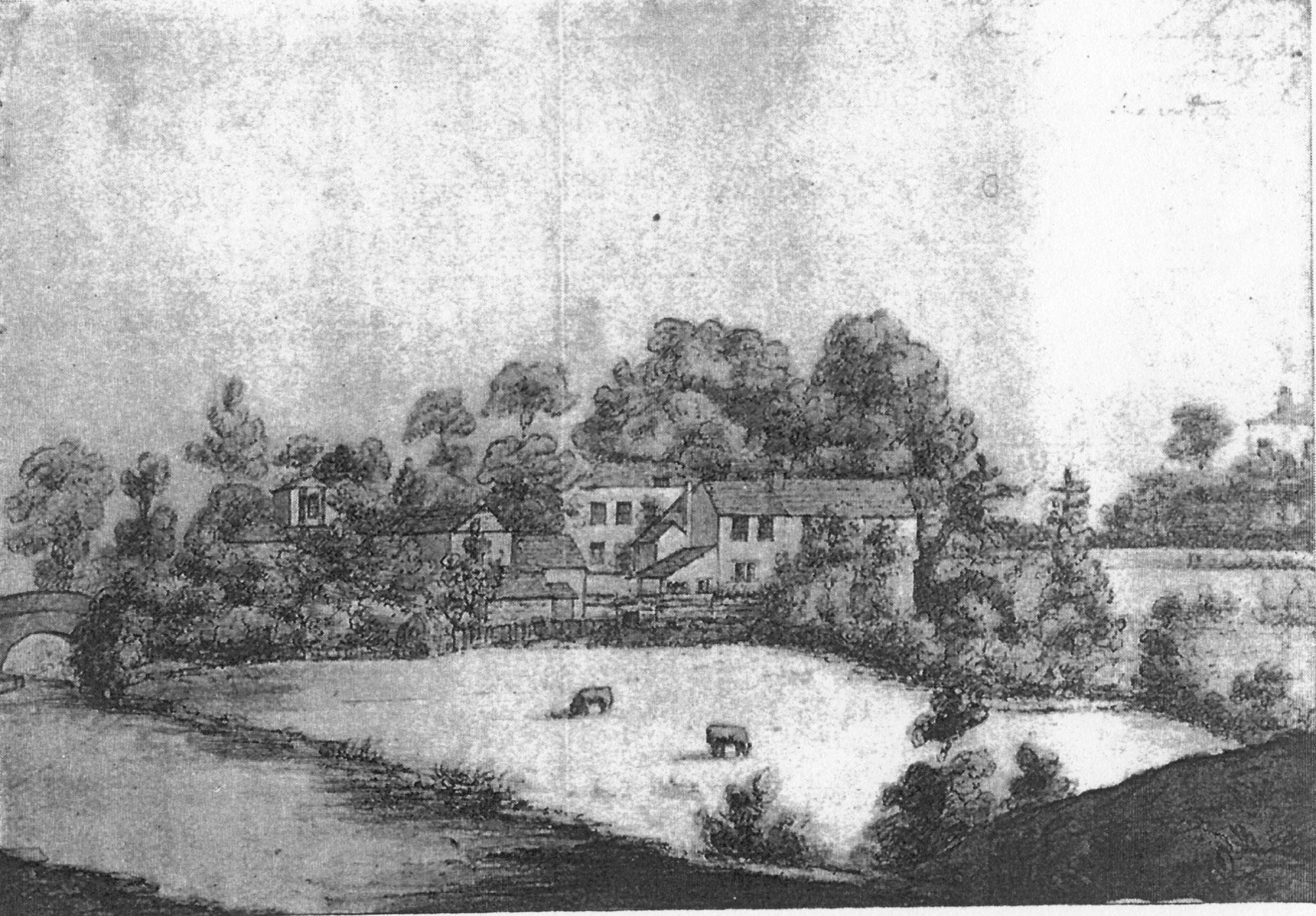
Looking towards The Greyhound and Sydenham Bridge. "This was drawn in 1818 and shows the Croydon Canal at the bottom left corner. The viewpoint is from about the present station footbridge over the railway line, and the cows are approximately in the present pub car-park."

Sydenham Bridge looking south.

Sydenham Bridge looking north.


Sydenham Bridge looking north. (*IMAGE IN NEED OF UPGRADE)


Two views of Penge Bridge. (*IMAGES IN NEED OF UPGRADE)

Penge Bridge.

Anerley. (*IMAGE IN NEED OF UPGRADE)


Anerley. (*IMAGES IN NEED OF UPGRADE)


A stretch of the Croydon Canal being used for recreational purposes as part of Anerley Gardens. (*IMAGE IN NEED OF UPGRADE)

Canal remnant after closure near Anerley Bridge.

Early view of the old canal remains in Betts Park, Anerley. (*IMAGE IN NEED OF UPGRADE)

Early view of the old canal remains in Betts Park, Anerley. (c1900)

Early view of the old canal remains in Betts Park, Anerley. (1905)

Early view of the old canal remains in Betts Park, Anerley. (1905)

Betts Park today showing surviving stretch of old canal.

Unknown stretch of the canal (*IMAGE IN NEED OF UPGRADE)

The surviving South Norwood Reservoir.


South Norwood looking towards Anerley. (*IMAGE IN NEED OF UPGRADE)


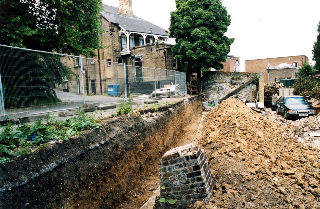
THIRD surviving section of the canal--"An unofficial access from Sunnybank accesses remains of the towpath bank itself (left) in which view we are looking along the former route southwards in the direction of Croydon. To the side (right) a substantial profile of the canal can be seen, in use as gardens, but some uncertainty about ownership appears to have left them rather open to access by members of the public. This stretch of canal was still watered in 1862, and according to the authors of 'South Norwood and the Croydon Canal,' the remnants of the canal finally succumbed to further house building by the end of the 19th Century."


Selhurst impression.

