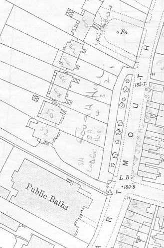
The top of Dartmouth Road curving round to Kirkdale was once known as the High Street before Walter Cobb brought it closer towards Sydenham Road. It seems this part of Kirkdale I'm referring to might also have been mistaken for an extention of Dartmouth Road; for example, I've seen the photo below captioned as being in Dartmouth Road.

I don't know much about those buildings in the background, and not even Steve knows what the tall building is on the right.
I've found some more photos lately, dated around 1912, and need help finding them on the map; I'm wondering if they could possibly match any of the unseen buildings outlined above?
133 + 135 High Street, Sydenham / Dartmouth Road (east elevation)

133 + 135 High Street, Sydenham / Dartmouth Road (west elevation)

135 High Street, Sydenham / Dartmouth Road

137 High Street, Sydenham / Dartmouth Road (west elevation)

137 + 139 High Street, Sydenham / Dartmouth Road (east elevation)

137 + 139 High Street, Sydenham / Dartmouth Road (west elevation)

No information....
