"Once west of Devonshire Road again there was a small wharf - Mr. Hawels' Wharf - to serve the aforementioned houses on the hill. Both wharf and houses were at the northern extremity of Sydenham Common"
also;
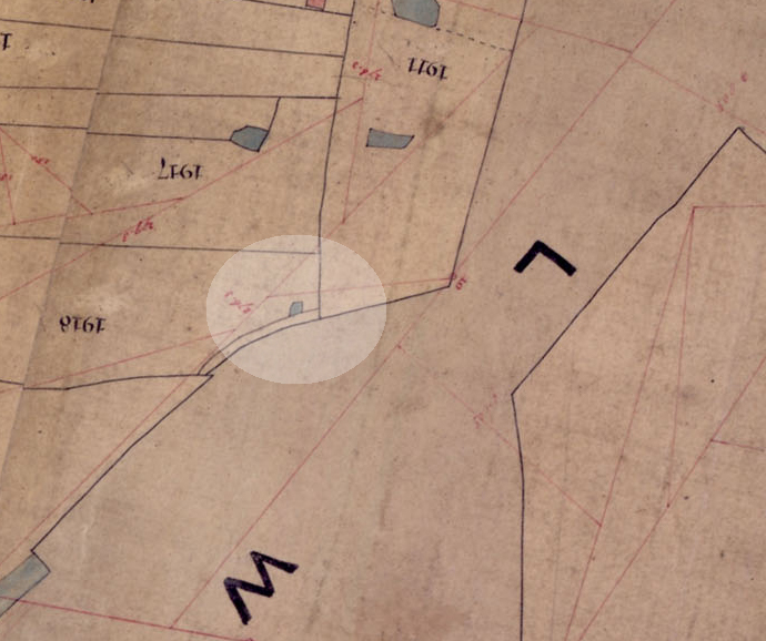
'south of it, on the border of sydenham common is another one,(inlet) marked Howies or Howls, who was a proprietor and entitled to a pleasure boat.....'
(from the Ken White book)
...so it could be seen more as a quay for a personal pleasure boat.
the inlet to the north, which I think should still be findable, is around 30 feet square, whereas the southern one, mentioned above, appears to be much less than 20 feet, in a kind of bay shape, so not much more than a mooring, really.
the Northern one is big enough to be a small coal wharf, but ther edont seem to be any connecting roads etc, so it would have been totally private, and probably dug after the canal was opened.
it doesnt really make sense.
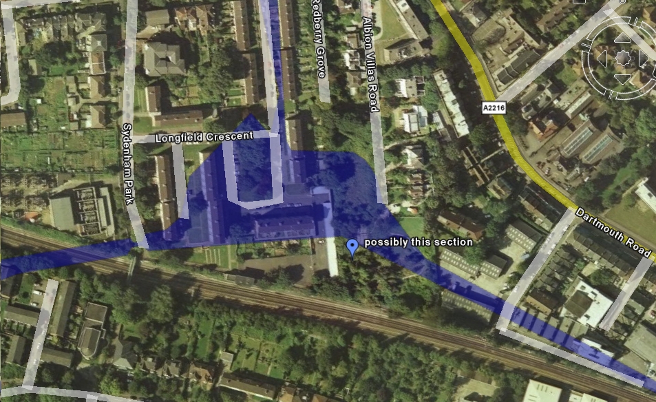
Steve, do you have any other maps of the devonshire road area showing the embankment....it seems even OS cartographers didnt bother mapping features inside the railway land.
(and sorry for not crediting my sources...I'll try harder in that respect.)
also. I think the 'Canal' house in Stanstead rd is more likely connected with the railway, or the woodyard that used to occupy that bend in the road, on the embankment...(behind the big white gates)
(does anyone have any images of this area, or Eliza place?
the area where the flats are, at the top of rockobourne rd, was bombed in the war, so there were prefabs there for a while...)


